Drone photogrammetry: 3D models, orthophotos and digital twins
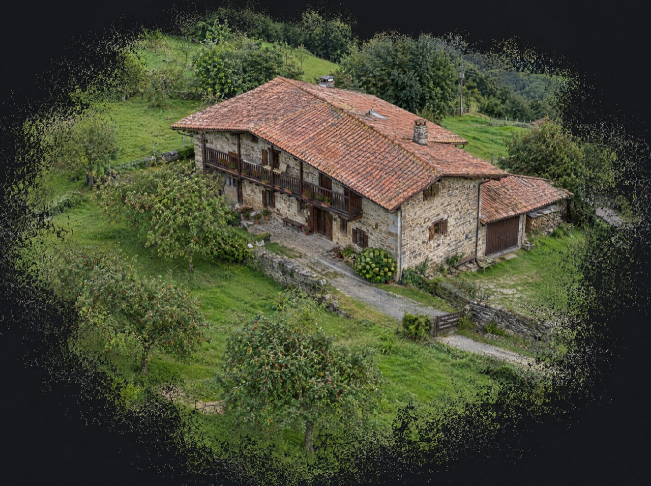
From hundreds of systematically captured aerial photos we build a 3D model of a building or site that you can rotate, measure and explore in the browser. We use photogrammetry for orthophotos and measurable models, and gaussian splatting for photorealistic digital twins that keep the finest detail.
What's included
- Planned photogrammetric flight (nadir and oblique)
- Textured 3D model or gaussian splat
- Site orthophoto
- Web viewer to share the model
- Export in standard formats (OBJ, PLY, GeoTIFF)
Made for
- Architects and restoration
- Heritage and museums
- Developers
- Virtual tourism
- Engineering firms
Starting prices, VAT not included, based in the Basque Country. Every flight is different: you get a fixed quote before the propellers spin.
Digital twins of buildings and heritage
Farmhouses, churches, façades or an entire site: a 3D model lets you study a building from the office, document its condition before restoration or present it interactively to people who can't visit.
Accuracy: what it is and isn't
Our models are excellent for visualising, approximate measuring and communicating. For centimetre-accurate mapping you need ground control points measured with GNSS; if your project requires it, we work with your surveyor or tell you upfront.
From a map pin to delivery
- 01
Brief
Send us the location (or a map pin), what you want to achieve and when. We reply with a flight plan and a fixed price.
LAT · LON · GOAL - 02
Permits
We check UAS geographical zones and handle whatever is needed: Interior Ministry, ENAIRE, heliports, ADIF or the landowner.
ENAIRE · AESA · EASA - 03
Flight
We fly with purposely chosen light and weather, within visual line of sight and with Remote ID. If the weather doesn't cooperate, we reschedule at no cost.
ALT ≤ 120 m · VLOS - 04
Delivery
Edited photos, finished video, maps, 360° panoramas or 3D models, in the format you need and with the coordinates of every shot when they matter.
JPG · RAW · MP4 · PDF · KMZ
Photogrammetry and 3D models · Frequently asked questions
What is gaussian splatting?
A recent technique that reconstructs a scene in 3D with photographic realism, including fine details classic photogrammetry loses. Ideal for immersive presentations.
How is the model shared?
Through a link to a web viewer that opens in any browser.
Other drone services
Permits are on us
Flying well isn't just piloting. We check UAS geographical zones and handle notifications with the Spanish Ministry of the Interior, ENAIRE (air navigation), heliport and aerodrome operators, ADIF (railways) or landowners. You just choose the shot.
We don't do thermal imaging, LiDAR, multispectral agriculture or light shows: they need equipment we don't have. If you need them, we'll point you in the right direction.
- UAS operator
- Registered with AESA (Spain)
- Pilot
- A1/A3 certificate, valid across the EU
- Aircraft
- DJI Air 3 · C1 class
- Identification
- Remote ID active
- Lenses
- 24 mm + 70 mm · 1/1.3″ CMOS
- Flight time
- Up to 46 min per battery
Where are
we flying?
Send us the location and what you need. We'll reply with a flight plan, the permits required and a fixed price.
Getxo · Bilbao · Basque Country — flying across Spain and Europe